Kaylor Knob
Kaylor Knob
Located on Massanutten Mountain on Massanutten Resort Property & the George Washington National Forest
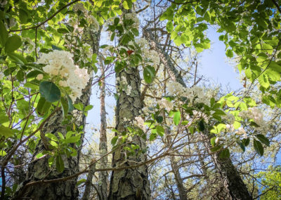
This hike along the ridge of Massanutten Mountain affords pleasant views of the Shenandoah Valley to the west and the Blue Ridge Mountains to the east. The views are more visible in the late fall and early spring when the leaves have fallen off the trees. In late spring, mountain laurel blooms along the trail. In the summer, refreshing breezes can be felt along the ridge. Be sure to check out the viewpoint of Massanutten Resort and the Blue Ridge Mountains at the parking area.
For more detailed trail information: Kaylor Knob Trail
Trail Information
Trail Activities: Hiking, Trail Running and Mountain Biking
Time required: 2-3 hours
Challenge level: Moderate
Distance: 3.6 miles
Elevation change: 429 ft.
Terrain: Rocky single-track following the ridge line, gradual grades
Preferred direction: n/a (out and back hike)
Practical Planning Information
Services along trail: None
Food and water: None
Phone service: Good service along ridgeline throughout the trail
Directions & Parking
Google: Massanutten Overlook
Driving time: <10 minutes from within Massanutten Resort, 35 minutes east of Harrisonburg
Signs and marking: Blue blazes
Parking: From Route 33, turn into Massanutten Resort via Route 644, and turn left onto Massanutten Drive. Then, turn right onto Del Webb Drive and follow the road through the golf course to the top of the mountain. At the top of the mountain, signage on the left hand side of the road will mark the Massanutten Overlook paved parking area on the ridge above the resort. 20 parking spaces.
Kaylor Knob
Navigating the Trail
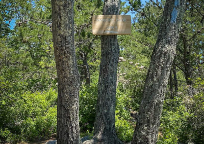
The parking area and trail are easily accessible from within Massanutten Resort, even if you are not staying there. There is no fee to enter the resort. Directly across the road from the parking area, head north along Kaylor’s Knob Trail. The trail is quite rocky, but the grades are gentle. Modest viewpoints will be visible at rocky outcroppings along the way. At 1.8 miles, you will reach Kaylor’s Knob, noted by a wooden sign on a tree. At this point, turn around and descend down the trail to return to the parking area.
This short hike can be extended into a challenging 6-mile loop with 2000 feet of elevation gain. Ample time should be allowed if undertaking this challenging hike. After 0.45 miles, cross a small creek over steppingstones. Then, at 0.5 miles, turn right at the junction of the Fridley Gap and Massanutten South Trails. Cross Mountain Run over stepping stones and ascend up the Massanutten South Trail. This trail is very hilly and rocky. Continue for 1 mile where the trail reaches the top of the ridge on Fourth Mountain. A narrow path on the right will lead to an overlook of Harrisonburg and the Shenandoah Valley below. Descend down the same trail to the parking area.
Note that the trails in this area, including Kaylor’s Knob, will be closed during hunting season. Hunting season occurs from November 5 to January 7 each year. During this time, be aware hunters may be active on National Forest lands. Wear bright clothing to make yourself more visible and consider wearing a brightly colored hat or vest. Whistle, sing, or carry on a conversation and alert hunters to your presence. For more information and safety suggestions, visit the Virginia DWR website.


